The Pecatonica State Trail runs along the Bonner Branch Valley through the rolling hills and rocky bluffs of southwest Wisconsin’s Driftless Area, a region that the glaciers didn’t scrape flat in the last Ice Age. The Pecatonica State Trail follows the old Milwaukee Railroad bed that at one time hauled lead through our valley. Mining once dominated this area of Wisconsin and brought a much needed livelihood to the area .
The 10-mile trail from Belmont to Calamine follows a branch line of the Mineral Point Railroad that the Chicago, Milwaukee, St. Paul and Pacific Railroad (Milwaukee Road 1869-1974) later acquired to haul lead from area mines. The railroad builders avoided the rugged terrain by keeping to the valley of this Pecatonica River tributary.
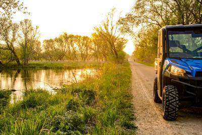
The Pecatonica State Trail is shared by ATVers (April 1–November 15), mountain bikers, horseback riders, and hikers in warmer months. When the snow flies, snowmobilers and cross-country skiers use the trail. Motorized use can make the trail passage rough in places, so it’s best to use the widest possible tires if you’re mountain biking.
When starting in Belmont, you may visit the home of the First Capitol, where the Wisconsin Territory was established. The two-story white clapboard capitol and adjacent Supreme Court buildings still stand, but nearly 3 miles north of town in the midst of cornfields. After Belmont had its year of glory in 1836, many residents followed the government to its new home in Madison or just drifted away. The final blow came in 1867 when the railroad laid its tracks to the south. Anyone who was left relocated to be near the railroad.
The trail starts on the west side of town where the railroad continued its route to Platteville, but the best parking and facilities are in shady Bond Park on the east side. Be sure to stock up on water and snacks, as there’s nothing east of Belmont unless you’re passing through Calamine on the Cheese Country Recreation Trail to Darlington (5.6 miles south) or Mineral Point (9 miles north).
Beginning at Bond Park, you’ll notice the asphalt trail turns to crushed stone on the way out of town. The trail twists and turns along the sluggish waters and crooked banks of the Bonner Branch as you cross 24 different bridges.
Oak and hickory trees shade parts of the trail. Elsewhere you’ll pass rolling farmland and tall grasses. Together this creates a good habitat for such birdlife as flycatchers, quail, and turkey. The valley deepens as you head east, and you’ll notice Bonner Branch spreading out into a marshy area as it joins the Pecatonica River right before you hit the Cheese Country Recreation Trail junction. A left turn takes you to Calamine and the trailhead there.
NOTE: ATVers must carry Wisconsin DNR registration to use the Pecatonica Trail. A State Trail Pass ($25 annually/$5 daily) is required for bicyclists and horseback riders ages 16 and older. Snowmobilers must display either Wisconsin registration or a snowmobile State Trail Pass. For information, go to dnr.wi.gov/topic/parks/trailpass.html. Pass for the Pecatonica Trail can be purchased at My Turn Pub.
Parking and Trail Access
To reach the western trailhead at Bond Park in Belmont from US 151, take Exit 26 toward Belmont onto southbound County Road G/First Capitol Ave., which becomes N. Mound Ave. Go 0.8 mile, and turn left (east) onto E. Platteville Ave. Go 0.3 mile, turn left onto S. Park St., and go 0.1 mile to parking for Bond Park on the left. The endpoint is located 1.1 miles west along the trail.
- There is parking for trail users at Bond Park in Belmont.
- https://dnr.wisconsin.gov/topic/parks/pecatonica
- Information on the Cheese Country Trail
- Cheese Country Trail on Traillink.com